Navionics, community works to improve intracoastal waterway charts
WAREHAM, Mass. – Navionics, the leader in content and location based services for the recreational boating and outdoor markets, announced today its community initiative to enhance the data accuracy of the Intracoastal Waterway (ICW). Stretching from Maine to Florida, the ICW’s bottom contours are highly susceptible to frequent shifts as a result of hurricane seasons, strong tidal fluctuations, changing currents and other acts of nature as well as man-made changes caused by construction, dredging and more. As a widely-used and trusted cartography resource for both chartplotters and mobile devices, Navionics is well positioned to make significant and timely improvements to ICW charts resulting in enhanced content and peace of mind for recreational boaters.
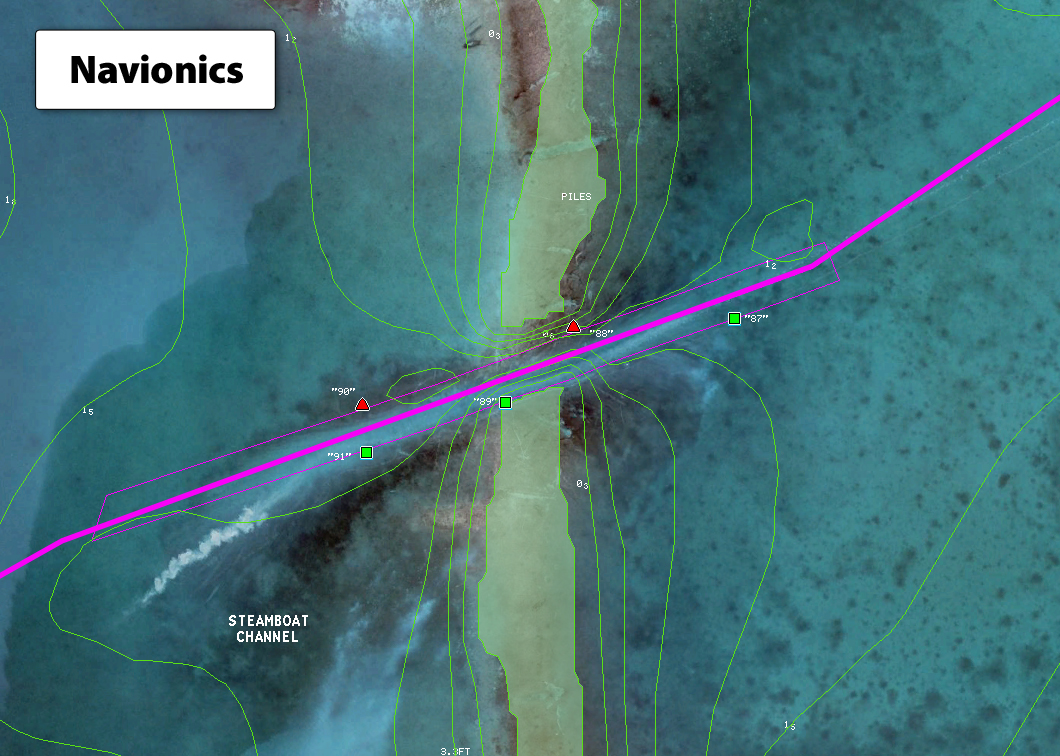
Harnessing the power of mobile user edits as well as its community generated soundings data, Navionics represents a great example of crowdsourcing for the benefit of all. Working both independently and hand in hand with its community, Navionics has made significant improvements; its ICW charts will soon feature up-to-date commanding depths, vertical and horizontal bridge clearances, accurate speed limits, vertical overhead cable clearance, updated coastlines, improved shoal presentation and much more – with daily Freshest Data improvements to bottom contours, suggested routes, and most notably, the disappearing Magenta line. Navionics also plans to incorporate validated routes into the Autorouting function – an upgrade found within its Navionics Boating mobile app.
“Thanks to more than 1.5 million users of our mobile apps, we are able to deliver invaluable enhancements to charting data at an unmatched pace,” said Don Black, global vice president of sales and marketing, Navionics. “Whether it is new hazards in the ICW, the impact of storms such as Hurricane Sandy, or bodies of water that do not receive priority attention from hydrographic offices around the world, our content is updated every single day and ensures boaters access to the most accurate cartography available. We invite all boaters to join us in our efforts to improve waterway safety.”
Navionics empowers its users with tools such as SonarCharts™ and Community Edits that allow them to participate in charting improvements. Boaters can easily upload sonar logs recorded with their compatible devices to the Navionics Freshest Data servers using a PC, and submit edits to charts using the Edit Map function on their Navionics mobile application. With thousands of boaters traveling the ICW and an unprecedented volume of user contributions, Navionics is well poised to maintain suggested travel routes with incredible accuracy.
Take a look at the Navionics Boating app in our App Directory.